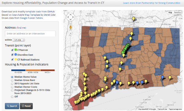
Diana Deng from the Partnership for Strong Communities created this interactive map of housing affordability and mass transit, based on guidance provided by Veronica Armendariz and the DataViz team at Trinity College. This map draws data from an easy-to-maintain Google Fusion Table, and the interactive map platform runs on an open-access code template created by Derek Eder at DataMade in Chicago. Learn more about the map and explore it on the Partership’s site at: http://pschousing.org/news/new-partnership-map-allows-users-explore-connections-among-housing-transit-and-population