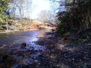
As we move forward with our projects, I have honed down on two specific ideas I would like to work on for this semester. One idea we would like to expand on is the Water Quality Story. Many streams and tributaries begin in the smaller areas outside Hartford and the more suburban towns, such as West Hard Hartford. As of right now, I am still in the process of searching for data on the water quality measurements, whether that be water sediment or levels of pH, etc. We would like to observe how affected the streams become as they begin flowing from the cleaner suburban regions to more urban environments. By depicting this data to the public, we can learn where pollutions are being dumped into the streams through point and non-point sources. Hopefully, with adequate data, we can be efficient in discovering how our neighborhoods and towns can work together to create a cleaner stream system.

The second idea includes working with public data about the different types of schools (public, private, etc.) and levels of education (primary/elementary education, high school) that reside in the Park River Watershed. Specifically, we would like to examine school systems that were built along the main rivers in the watershed. This knowledge will allow schools to build a greater and stronger network within their science programs as well as with each other. With a better support system, students will be able to foster their environmental interests further, and school officials and teachers will have an easier time implementing interactive science into the education system.
With school information around the Hartford area that Professor Jack Dougherty has given me, I was able to upload the data onto Google Fusion Tables to create a Point Map. Utilizing this tool for these points of schools is a great way to portray what my partner organization and I would like present. Below, the red dots on the interactive map show the different types of schools in and around the city of Hartford.
I have also found a shapefile layer of the Park River Watershed, which can be converted into a .kml file and can easily be uploaded to Google Fusion Tables as well. In the map below, the watershed can be seen outlines in red.
I would really like to be able to merge the the point map and the polygon layer of the watershed into one map. The polygon layer would need to be somewhat transparent in order to show the points. I believe this type of dataviz created does fit my partner’s needs in terms of illustrating a map that shows school points over the Park Watershed. Once I learn how to combine points with a polygon layer, this map will look more like what I have envisioned.
Here’s a couple examples of how I would like my merged map to look like.