Assignment 10: Presentation and transfer and training plan-KNOX

Posted on

Part 1: Update the data and photos
Go to Google fusion point table and click on “Rows 1” on the tabs
To update current data in the spreadsheet:
-Click certain cell to edit the data information.

To add more columns or rows:
-Click “file” in the upper panel and “import more rows”; or click “edit” and “add row”.
-Click “edit” and go to “change columns”, “create a new column”. Select type among text, number or location.

To update photos:
-Upload photos on WordPress, and copy the html link. (photos have to be on the website and have a html link in order to appear on the map)
-Insert the link under the photo column

Part 2: Maintain the website
1. Sign up for a free GitHub account
2. Go to the current repository I use for community garden map. Click “fork” on the top right corner to make your own copy of the map.
Screen Shot 2016-04-21 at 下午11.10.27
3. Your new repository automatically starts opens the “master” branch. Go to “branches” and delete all branches besides the master branch. Use the drop-down menu to create a new branch, and name it “gh-pages” (which is short for GitHub Pages), and press enter or return on your keyboard.
4. Go to gh-pages and README.md file to change the link to your new map. Click on the second icon, “edit”, to make changes. Under “Demo”, there’s the current link to the map: http://doris0221.github.io/fusion-point-polygon-4/index.html. Delete “doris0221”, which is my username, and change it into your username. Scroll down to the bottom and click on green button to “commit changes”.
Screen Shot 2016-04-21 at 下午11.18.13

Screen Shot 2016-04-21 at 下午11.21.20

Part 3: Change website and map appearance:
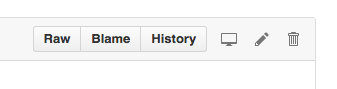
1. Stay on gh-pages and go into index.html. Click “edit” to make changes. Read in detailed and pay attention to where it says “MODIFY”.
2. For example, if you want to change the title that appears on the website, simply look for the current title “KNOX Community Gardens Map” and replace it with the new title.
Screen Shot 2016-04-21 at 下午11.29.06
3. In index.html, you can change the following features:
Website title
Description on the top left corner
Address tool
Filter tool (checkbox icon color and titles)

Reference: Data Visualization for All –Jack Dougherty

Assignment 8-KNOX demo

Posted on

link to map demo: http://doris0221.github.io/fusion-point-polygon/

My partner is expected to see an interactive map with two layers. On the first layer, it shows the all the community gardens with detailed profile information. The profile includes the address, the number of plots, photos of the garden, spot availability of the garden during the year and greenhouse availability(3). The second layer shows the Hartford neighborhood border, which divides gardens into different regions and also gives audience an easier way to visualize where their closet gardens are. Adding on to this border map, there is also a search tool, like the one in Google map, for audience to search by address. Audience can simply type in their own address in the toolbox. The map will then lead the audience into the closet garden according to the location. Moreover, there is another filter tool on the side of the map. The tool filters out by the information listed in the garden profile, such as the greenhouse and garden plot availability.

Steps completed:
Make point map
Make polygon map
Merge two maps into layer map
Create filter tool
Collect photos

Steps to be done:
Make photos appear in the profile–demo:https://support.google.com/fusiontables/answer/2527132?hl=en
Collect more photos
Fix filter tool
Edit code in github

Income distribution in Conneticut

Posted on

The two maps illustrate the income distribution by region in Connecticut. For the first map, I want to “lie” a little bit about the household income distribution visually so that the income distribution looks similar and equal in the state. I chose a wide range of data from 29,313 to 130,000, where most of the data falls into. On the other hand, there’s only few data falls in the other two ranges. So on the map there is little difference among various household income.

For the second map, I want to display an “inequality” of the median household income in the state, so I set a different range. In this map, one range doesn’t have such a great jump as the one I set for the first map. In this way, there are similar amount of data in each range and I could show the great difference in median household income on the map.

Knox. Community Gardens Point Map

Posted on

Google fushion table:

BatchGeo:

MapMe:

Marking the same data set on different software, I found out different tradeoffs from Google fushion table, BatchGeo and Mapme.

Google fushion table has more freedom in terms of filtering out the actual information we need. Also there are some features that we can self custom, such as the color of the point, shape and also the column that needs to be mapped on.

BatchGeo:
BatchGeo is an easy and fast operated mapping software. An easy process of data import can help user complete a standard point map. Nevertheless, the features that user can change due to self-need is sort of limited and photos cannot be added on in the data profile.

Mapme has an easier and clear layout that the software itself has designed for us. Few essential features are listed on the left side. User can add in data point one at a time if it’s a small dataset and just needs to type in the information as well as pictures that needs to be presented. User can also import data directly, whereas the software takes time to read the data smartly.

Special Education Prevalence in Hartford surrounding area 2008-2013

Posted on

The continuous lines show the trend of how the overall special education prevalence trend has changed from 2008 t0 2013 in Hartford surrounding area, including Hartford, East Hartford, West Hartford, Wethersfield and Willington. The X-axis shows the years, and Y-axis shows the prevalence in percentage. Different trend lines show different regions and can be filtered on the right side of the chart. This graph can lead the Education Department into deeper and broader research on improving special education system in Connecticut.