Training and Transfer of Ownership to the Hartford Food System

Posted on

Transferring the Visualization’s Ownership:

For this project, Kaitlyn and I have used Google Fusion Tables and GitHub to manipulate the data into a Visualization. Transferring the ownership of the visualization should be easy since Google Fusion Tables can be shared and edited by the Hartford Food System through email. Google Fusion Tables creates the map part of the online visualization, and editing these tables change the points and polygons. With the power to edit the Google Fusion Tables, the Hartford Food System will be able to add new data and upkeep old data while simultaneously updating the online map. In case the Hartford Food System change other parts of the visualization like the legend or the position of the maps, Kaitlyn and I will share the code via GitHub. This code can be ‘forked’ from our project’s repository and then edited if necessary.

Adding and Updating the Visualization’s Data:

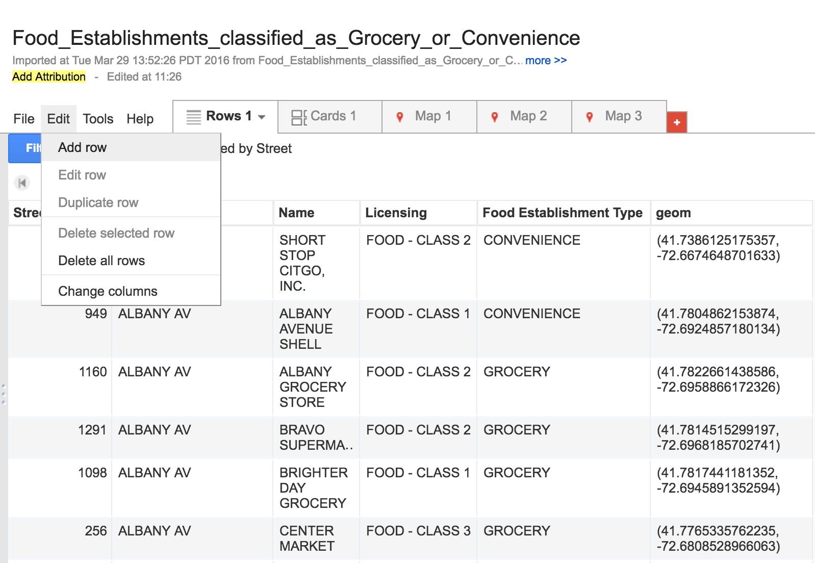
Data about food establishments in Hartford can be found on the city’s open data site. For example, the data that we used for our food establishment types here. The city of Hartford also updates this data on a regular basis. Current data can also be edited by double clicking on the table’s cells or selecting the ‘edit’ button that appears next to the cell.

Screen Shot 2016-04-07 at 8.18.33 PM

New data can be singularly added by selecting ‘edit’ on the toolbar and then ‘Add Row’, while new data sets can be uploaded as excel and KML format by creating a new Google Fusion Table document.

Screen Shot 2016-04-07 at 8.11.30 PMScreen Shot 2016-04-07 at 8.09.38 PM

The polygon’s map information can also be altered and updated. Currently, we are using the 2014 ACS 1-year estimates for the data in the Polygon. This information can be updated annually. To do this, new American Community Survey data sets should be uploaded to a new Google Fusion Table and ‘merged’ with the Hartford Census tract KML file. Both spreadsheets must share the same information in at least one column, like the names of food establishments. More information and the step-by-step instruction on how to merge spreadsheets on Google Fusion Tables can be found here.

Changing the Visualization’s Characteristics:

The ability to change the colors and information displayed by the polygons can be done in Google Fusion Tables. To do this, the Hartford Food System can select the ‘Map 1’ tab and then ‘change feature styles’ or ‘change info window” button on left side of the screen.

Screen Shot 2016-04-08 at 10.18.46 AM

However, if the Hartford Food System decides to change the data point colors or the legend’s characteristics they will have to modify code in GitHub. In his data visualization book, Jack Dougherty explains step by step the process how to extract, or ‘fork’, a visualization’s code to another GitHub account. Kaitlyn and I will share the link to our GitHub repository so the Hartford Food System can extract the visualization’s code.

Data Sources:

Food Establishment Types and Classes

American Fact Finder ACS download tool

Hartford Food System

Posted on

Map

Our partner would like a map of food access in Hartford, including grocery stores, convenience stores, farmers markets and community gardens. They would like us to indicate all the places that are WIC certified, as well as bus routes. The map would serve two purposes: (1) to give Hartford residents an easy way to find healthy, affordable food in their neighborhood, and (2) to highlight the serious issue of food insecurity in the poorest areas of the city. Using polygons, we will demonstrate the income disparities of the different census tracts.

So far, we have mapped all of the grocery stores, convenience stores, and farmers markets as points. We still need to need to map the farmers markets and all of the places that are WIC certified. Then, we will need to add the CTTransit bus routes and the polygon data on median household income.

Extreme poverty in Central Connecticut?

Posted on

I chose to use the measurement as percentages of households that make less than $10,000 annually to demonstrate the amount of severe poverty in differing census tracts in central Connecticut. In the “lying” map, someone that takes a quick look would make the assumption that there isn’t much severe poverty or disparity in the region. Well that’s because one color represents zero to thirty percent of people in the tract that are below the $10,000 threshold. Zero to thirty is a very large range, and few tracts, even in the poorest cities, will have more than 30 percent. The second map is much less deceptive, and actually depicts the income inequality on the West Hartford-Hartford border with its better use of cutpoints of percentages.

Comparing Various Mapping Tools

Posted on

MapMe

BatchGeo

Google Fusion Tables

Of the three mapping programs, BatchGeo was my favorite. In addition to being the most aesthetically pleasing, it was by far the easiest to use. I was easily able to import my data and I did not have to reformat my Excel document in any way. However, the free version does not support more than 250 entires, so I was not able to geocode all food establishments in Hartford. Thus, I chose to just map restaurants around Trinity. I also appreciate that BatchGeo uses Google Maps as its source.

On the other hand, MapMe was the most difficult. In order to import data, I had to download their Excel template, and then I had to transfer all of my data into the template for it to be imported. This took a considerable amount of time.

In regards to Google Fusion Tables, I’m not exactly sure how I feel yet. I think that it is the most difficult to learn, but will eventually yield the best results once learned. I have just learned how to set a column to “location” and I am still struggling to embed this map.