Cassia made a cool video about this year’s Iceland trip. You can check it out here:
Iceland Video
Reply

Cassia made a cool video about this year’s Iceland trip. You can check it out here:
 This Saturday Christoph’s first-year seminar presented the fruits of its semester-long photography project at the annual Knox Parks Foundation harvest Market. The students had been learning about the role of nature photography in conservation efforts and complemented their classroom work by visiting several community gardens in Hartford and taking pictures.
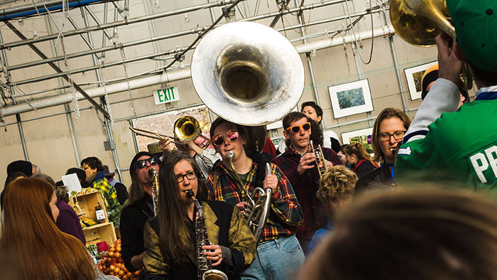
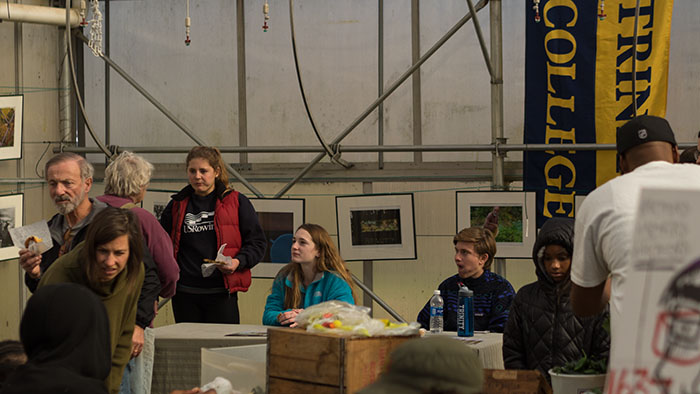 KNOX Parks was nice enough to give us a large corner of their greenhouse to display our images and to set up a little information table where we told visitors about the project Alley and Noelle did an amazing job distributing our catalogs, and everybody had a good time, enjoying the music of several bands, sampling local food (it was Cecilia’s first exposure to Mac and Cheese) and meeting up with some of their photography subjects.

image by Josselyn Zaldivar
 Christoph was also busy recruiting potential speakers for next year’s 149 class. So, all-in-all it was a great success.
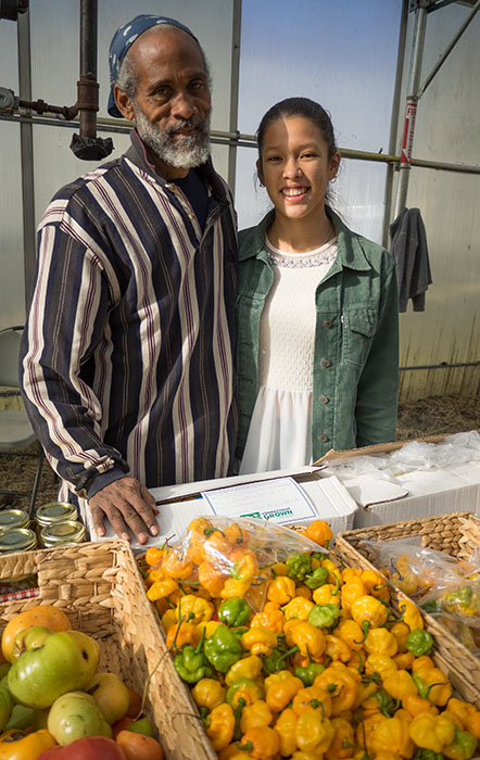
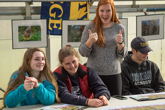 Here are a few examples of our artwork:

image by Cecilia Wang
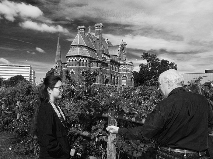
image by Noelle Casey

image by Jarrod Swain

image by Madi Guay

image by Jake Mores

group portrait by Emily Hamilton
Who wouldn’t be excited to go to Iceland!
We are excited to announce our 2017 field trip to Iceland and are even more excited to be able to offer it to current students, just graduated seniors and alumni. The trip will begin and end at Boston airport (alumni could arrange for different starting points), includes two days in Reykjavik and our classic hike along the Laugavegur.

Taking sunset pictures in Reykjavik.
The trip dates are Sunday, June 18 2017 – Friday, June 30 2016. The cost will be between $1750 and $2000 (more below).
While in Iceland we will camp or stay in Huts (at Baldvinsskáli, Emstrur and Hrafntinnusker) that are operated by the Icelandic Touring Association (Ferðafélag Íslands). We’ve been to Iceland many times and the weather has ranged from super sunny and nice to driving rain and utterly miserable with everything in between – most of the time it’s pretty nice! In any case, we supply the tents, but you should bring a good sleeping bag. Every once in a while we throw in some geothermal heat on top of a volcano.

Camping in Landmannalaugar – the worst campsite of the trip, but the hot springs make up for a lot!

The rhyolite hills of Landmannalaugar.
The total cost of the trip (between $1750 – $2000) dollars will depend a little bit on the cost of local transportation and airfare. We’re getting quotes for the bus right now, airfare will be influenced by when we are able to lock in the tickets. That price includes airfare from Boston (if you are an alumna / alumnus and want to meet us in Iceland lets talk), local transportation, all the food on the hike, and a visit to the Blue Lagoon at the end of the trip (overrated, but your fellow folks on the plane home will appreciate it). It will not include food in Reykjavik where you can enjoy the most amazing hot dogs ever or dine in five star restaurants on Arctic char, lamb chops and smoked puffin (supposedly rather salty).

Puffy on the bus. That little guy always had the best seats…
The centerpiece of the trip will be a hike from Skogar (on the southern coast) to the hot springs of Landmannalaugar. Daily hikes range from 8 – 10 miles a day, and we usually are in camp by early afternoon. That leaves plenty of time to hang out, relax, stalk the local flora or just tend that blister on your foot.

Hiking between amazing volcanoes.
Every once in a while we will have to ford a river. It’s exciting the first time, and at the end you’ll think nothing of swimming through glacial streams the size of the Amazon river. Piece of cake! OK, I exaggerate a bit: the rivers are just deep enough to earn some bragging rights (see below).

Most river crossings are bridged. The ones that are not ain’t that bad. The water is well-heated and pleasantly refreshing. :-) Yeah, check out Jenna’s face.
While on the trail we’ll do our own cooking. By now we have it pretty much figured out and we’ll chat with you guys about food choices, menu planning etc.

Chef Jon at work.
Itinerary:
Sunday, June 18th – leave Boston in the evening (around 8 – 9 PM)
Monday, June 19th – arrive in Reykjavik, transfer to campground, time to explore the city on your own (very walkable), check out the dried fish or local hot dogs. The best dogs can be found right next to our campsite (Bill Clinton had no idea)

The best hotdogs can be had right outside the the Laugardal pool, minutes from our campsite.
Tuesday, June 20 – Like pretty much all tourists, we’ll do the Golden Circle, a tour of Thingvellir, Gullfoss and Geysir. Unlike 99.9% of all tourists we’ll spend the night at Geysir so we’ll have plenty of time to enjoy the geysers in the evening sun. That day you’re on your own for dinner. The local restaurant has plenty of choices, and the campground isn’t really great for cooking (a conspiracy ??)

Strokkur, the local geyser going off every few minutes or so.
Wednesday, June 21 – today our hike begins in earnest: after a morning bus ride to Selfoss to stock up on last minute supplies we head east along the coast, where we might stop at Seljalandsfoss. Here you can walk behind a waterfall (also last chance for hot dogs, muffins, coffee). Then we begin our hike at Skogar with hundreds of steps straight up from the parking lot, hundreds of waterfalls, and a hut just under the glacier where we will spend the night. It’s steep, it’s long, the weather will likely turn on us halfway up, but once you’re at the hut it is sooooo worth it!

Yes, we all fit, but Jon had to spend the night with a bunch of German girls.
Thursday, June 22 – Today we hike through the pass at Fimmvörðuháls, where we will most likely encounter some snow and ice before we reach the two craters Magni and Modi (named after the sons of Thor), the site of the first eruption of the Eyjafjallajökull volcanic eruption. If you’re lucky the earth might still be toasty warm, years after the event.

The steaming Magni crater in 2011. It was still pretty warm and toasty in 2014.
From there we head down into Thórsmörk, where we camp in a nice sheltered campground near the hut. Thórsmörk, by the way, has the third largest flag in Iceland (according to the warden).
Friday, June 23 – Today we stay in Thórsmörk. There are plenty of little hikes to do (Christoph still wants to explore the famous cave waterfall, which is the star of many German guidebooks, but which has escaped him now twice), you can head over the mountain to hang out at the next bar or just be lazy and relax after two days of hiking.

Hiking into Thórsmörk.
Saturday, June 24 – We start the day with our first stream crossing (nothing to worry about) and then hike all day along the river Markarfljót, in sight of one of Iceland’s coolest mountains, Einhyrningur. When we’re almost at the hut as the crow flies we still have to go way down to the bottom of a steep gorge, cross a raging stream (on a bridge) and work our way back up the infamous Botnar Step before we reach our destination, the hut at Emstrur (Botnar).

The huts at Emstrur.
Camping here is so-so, and we’ll stay in the hut.
Sunday, June 25 – Today the trail goes through a large gravel plain, where we hike between big moss-covered volcanoes. After a relatively flat hike and a few river crossings we camp at the hut at Álftavatn. The lake is close and if the weather is nice you might consider a swim, but be forewarned: even though the lake is supposedly very deep, the northeast shore is not and you walk for hundreds of meters until you’re in deep enough water for a swim. Going in is not so bad, but going out, wet, in cold wind … :-(

Our camp at Álftavatn.
So it might be better to go for an evening hike or take a nice hot shower.

Evening at Álftavatn.
Monday, June 26 – Up to Hrafntinnusker! After a nice walk in the valley we climb up the side of a big caldera to go into the Landmannalaugar region proper. This can be a great hike with amazing views if the weather cooperates (with possibly a little side trip up to Háskerðingur, a really cool, but very steep mountain with an even more amazing view). In any case, we’ll stay at Hrafntinnusker. The camping here really stinks and that’s why we stay in the hut.

Out group at the Hraftinnusker Hut – we’re still looking pretty good after six days on the trail!
Tuesday, June 27 – Today we have one more ridge to climb before we head over the rolling rhyolite hills of Landmannalaugar, past the first hot springs (too hot, too muddy) and amazing lava flows. Just before we head down to the hut we have to descend a couple hundred meters. Here you can smile at the poor folks who have to crawl up the steep hill on their way to Thórsmörk. Don’t feel too bad for them – they have four or five days of amazing hiking still ahead of them… We head down to the hut, where we set up camp before we jump into the springs.

Its a tough job, but somebody has to do it.
Wednesday, June 28th – we have the entire day to explore the amazing landscape of Landmannalaugar. You can hike up Bláhnjúkur, a nice little mountain with an amazing view, head out farther into the wilderness preserve, or just take it easy, drink coffee with “ze Germans” in the Mountain mall, hang out in the hot springs, or catch up on sleep. The choice is yours.

Rhyolite hills near Landmannalaugar.

Some of the treasures of the Mountain Mall.

Hiking in Landmannalaugar.
Thursday, June 29 – This afternoon the bus will pick us up and we’ll head back to reykjavik, where you have the rest of the day to shop for presents (Jon is the expert on Icelandic sweaters), take the elevator up Hallgrimskirkja (great view across the city), or soak your bones in the hot tub (and follow it up with three last hot dogs). It’s all up to you.

Reykjavik’s skyline reflected in the windows of the new opera house. Yes, that would be another option.
Friday, June 30 – One last chance to sample Icelandic pastries for breakfast (very sugary and delicious) before the bus picks us up for a trip to the Blue Lagoon. Here you can soak in geothermal waters, get a silica mud facial, buy expensive souvenirs and clean up, so your neighbors on the plane won’t hate you. From there it;s only a short trip to the airport and back to Boston.

At the Blue Lagoon.
So, if you want to go and are not on my list yet, drop me an e-mail at:
christoph.geiss_at_trincoll.edu (you know how to change the _at_ into an @
We can’t wait to hear from you!
Christoph
P.S.Oh, and for all you guys who want to know such details:
Jon and Christoph will be leading and organizing the trip, Amber will chase the elusive Icelandic salamander (Salamandra islandica heklaensis), while we expect Krista to identify every cinquefoil down to the subspecies level.

Lucian and Myles having way too much fun describing floodplain soils
Our measly winter has been coming to an early end this year. Even before the first spring flowers appeared, Christoph took his soils class out of the classroom and into the field. Digging was a bit limited a few weeks ago when he and his students visited Zion Cemetery, where soils are characterized by a thin deposit of eolian sediment. Here we described our first soil profile, measured infiltration rates and tried not to look too suspicious.

Doing a bit of sampling in the local cemetery.
This week we went to Wethersfield Cove, where we studied floodplains and floodplain soils. The river was still high, but none of us got too muddy, and we had a good view of the partially flooded floodplain and immature floodplain soils. Next week we’ll be digging up the hydric soils of Wintergreen Woods and, maybe, the Wilkus Farm.

Lauren determining soil color.
Cassia sent me this link today. What an awesome videographer she is. That also means I can take the day off. Skull Rapids will have to wait for a day.
Enjoy!
[klee-uh-pa-truh, -pah-, -pey-]
noun

Sarah on the Cleopatra – well deserved, since I still owed her 1.5 hours of sleep.
Today was not a good start for – not quite a morning person yet – Sarah. My papers said that we would meet our rafting guides at 8AM in the pretty much abandoned town of Cisco. We got there by 7:30 only to realize that we were 1.5 hours early and that there is nothing, that’s right: absolutely nothing, to do in Cisco. Luckily, the trip to the Westwater ranger station (the beginning of our rafting trip) was short (we left Allen by the Cisco boat launch) and once we had all our stuff packed away on two rafts we were all eager to go. Our rafting guides Susan and Colin were awesome and we were off to new adventures in no time at all.

Into Westwater canyon
Soon we left the Westwater ranger station behind and floated down the Colorado. Colin told us about the rapids, Adam was paddling happily in a small inflatable kayak and we made fun of Joan, who had unceremoniously departed her raft on a previous whitewater trip in Oregon.
Adam in some small rapids.

On the Colorado River
We had lunch at Miner’s Cabin, where Colin and Susan pulled an amazing Cesar Salad out of the coolers and we all munched on wraps, Pringles and cookies. Down river we went until we reached Little Hole, where Susan took us on a hike to a large alcove with petroglyphs and a great view. The alcove was just the place to be: we go surprised by a little thunderstorm. Luckily we all stayed dry under the big overhang and enjoyed a short-lived waterfall pouring over the edge of the sandstone cliff.

Petroglyphs

A short-lived desert waterfall.
A few miles downstream we pulled into our campsite at “lower little D”, (or lower Little Dolores), the Little Dolores being a small stream entering the Colorado from the east. The site is great: lots of good camping on top of a small bluff of Precambrian black metamorphic rocks, a nice sandbar, no flies and an awesome dinner cooked by Colin and Susan under a small tarp during two thundershowers. The pineapple upside-down cake turned out awesome, and so did the steaks and everything else.

The little Dolores running blood-red from some spring thunderstorms.

Photobombed!
We did a little pre-dinner hike to a small waterfall, enjoyed the peace and quiet, and late evening campfire. No s’mores though. Joan and Christoph decided that this is definitely the way to travel!
Half a peach pie to be precise! Half a peach pie on sale at Moab’s City Market grocery store and purchased while waiting in an endless line at Starbucks. Joan wanted coffee, Christoph was happy to get out of grocery shopping (how long can it take to buy to cups of coffee ??) and definitely pulled the short straw. Two billion soy macciatos with hazelnut, a dash of 2%, a sprinkle of cinnamon, and “oh, would you mind filling my water bottle too” later Christoph was still half a dozen customers away from putting in his order, while Joan had purchased all the needed groceries, packed the van, went to the bathroom, rinsed out her travel mug, read the newspaper, called her husband, rescued a Caracara somewhere in Oklahoma – and refused to buy pie. Lauren, Hadley and Christoph bought it while (still) standing in line and and shared it with Sarah later that night. I’ve never seen three girls inhale a pie faster! Ever! Why we went to City Market in the first place? I have no recollection.
After our shopping spree we backtracked a bit and headed into the La Sal Mountains on the La Sal Mountain loop. We had lunch at Warner Lake campground, where it was pretty chilly but beautiful amongst all those aspen trees. That’s definitely a spot to keep in mind for summer camping.

Warner Lake campground.
After Adam had emptied out half the strawberry jam onto one taco and a few last bathroom visits we headed up the trail to Gold Knob. We first hiked through lots of dark conifers before the trail gained height through some wide switchbacks that led us through more beautiful aspen trees.

Lauren, Hadley and Sarah and plenty of aspen.
Almost there Joan, well – not really.
After about an hour or so we reached the saddle between Gold Know and the rest of the La Sal Mountains and headed through the grass straight to the peak.

Adam and Christopher almost up there.

At the top of Gold Knob. The snow was pretty deep as Hadley can tell you.

View into Castle Valley.
We spent maybe half an hour up on top, enjoying the views, eating our snacks and checking text messages…
After our return to Warner Lake we finished the La Sal Loop, drove through Castle Valley and all its subdivisions, and camped at a so-so campsite at Dewey Bridge, at the banks of the Colorado. No record exists of the demise of the peach pie.

Our camp at Comb Wash. Tiny Allen hiding under plenty of majestic cottonwoods. Did I tell you that they are my favorites?
:-)
This morning we decided to brush up on history and culture and visited the highly recommended Edge of the Cedars State Park and museum. The exhibitions were outstanding and we spent quite some time looking at artifacts, photographs and a partially excavated ruin in the back yard of the museum. Joan and Christoph made sure that everybody had read and re-read the little display on “context”, which is just as important in notebook writing as it is in archeology. Lunch was spontaneously had at the local Subway while the professors stood in line to get their daily coffee fix. Then we headed through the Abajo mountains to Newspaper Rock.

The man-eating cows depicted on the rock were a true menace in 2002. Clearly they were early risers and did not look kindly on sleeping in. Rumor had it that on our very first ENVS fieldtrip they got the students out of their sleeping bags by giving the tents a little shake-down. How they did that without opposable thumbs will always remain a mystery, but they did make it onto the back of our very first field trip T-shirt:

The very first ENVS shirt – ever!
The campsites in the Abajos were pretty empty but they also looked pretty cold, so we moved on and hoped for a site at Windwhistle campground. We were in luck. After a long drive we arrived at a mostly empty campground and picked two sites before we headed out to Needles overlook, a few miles down the road.

Needles Overlook
View down from Needles Overlook.
Afterwards it was time for some reflections and landscape observations. The group dispersed, looked for a comfy spot and wrote down some solo observations.

Sarah writing her solo-observations.
Since too much solitude is not good for you either, the evening ended with some fierce card games after dinner.

Not exactly sure whose winning, but Lauren looks pretty intense!

Sunset over Windwhistle campground.
Yep, this title makes more sense when you hear me say it. Just imagine a thick German accent!

Horsecollar Ruins in Natural Bridges N.M.
We left early to visit Natural Bridges National Monument. We got there just at 8 AM to use their bathrooms and steer some business to the visitor center’s gift shop. Afterwards Christoph dropped the group off at the Sipapu Bridge trailhead. As soon as the last student had disappeared into the canyon he turned that van around and headed to the next Starbucks – yeah, not quite. A quick visit to the Starbucks website showed that the closest store would have been back in Moab. So, he went to the Kachina Bridge trailhead and picked up the crew after a short hike through the canyons.

Kachina Bridge
Next we headed south towards Muley Point, one of our favorite viewpoints in the region. Unfortunately the weather was too bad, and Allen not quite up to the task of driving on a very slippery dirt road in drizzling rain.

The view from the Moki dugway. The name probably comes from “Moqui”, the Spanish name for the nearby Hopi tribe.
The view wouldn’t have been that great anyway, so we turned around and drove down the Moki dugway, an impressive couple of miles that go pretty much nowhere, except straight down (or up). We had lunch at the Goosenecks where we admired the incised meanders and talked with the ranger in the ticket booth about the dirt road out to the Honaker Trail trailhead. He was pretty much clueless.

The goosenecks of the San Juan.
Luckily the description in our guidebook was spot-on, Allen enjoyed the improved dirt road and took us even closer to the trailhead than the book suggested. It had begun to rain again, and we hiked the first mile or so in a steady drizzle.

At the beginning of the Honaker Trail.
After a mile across the sagebrush we arrived at the canyon rim. A small cairn indicated the trailhead, but it was far from obvious how we would reach the San Juan, approximately 1300 ft below us. The canyon walls seemed pretty much vertical. Nevertheless, there was a trail, the guidebook assured us that it would be a piece of cake, and down we went.

Adam and Christopher trying to give Joan a heart attack halfway down the canyon.

Almost down by the river.
The trail was pretty easy. It consisted of short, steep sections through breaks in the cliff-forming rocks that were connected through long, gently sloping switchbacks in the slope-building weaker sediments. It took about 90 minutes to get down and less than that to get back up to the canyon rim (fewer photo stops).

The canyon of the San Juan river.
In the meantime it had even stopped raining, and after an exciting hike we arrived back on top of the canyon and could see Allen waiting for us in the distance.

Allen on the horizon.
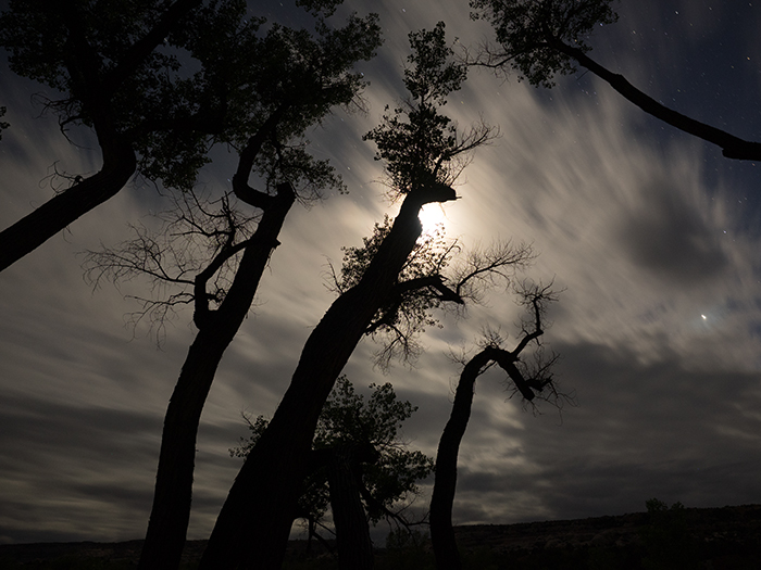
Comb Wash at night.
From here we briefly stopped at the Sand Island petroglyph panels and had showers in Bluff before we returned to Comb Wash for a rather late dinner under the cottonwoods.
back to Day 5
onward to Day 7

Our campsite at the Colorado River.
Today started with a long drive from Onion Creek back to Moab and South to Natural Bridges National Monument. Unfortunately we missed out on a campsite in Natural Bridges, which had us backtrack all the way to Comb Wash, where we had lunch under large, scrappy-looking cottonwoods. Yes, they still are my favorite trees – they exemplify the West, and nothing beats falling asleep under their rustling leaves.

Cottonwoods galore – who cold wish for a better campsite…
Cassia discovered a nice big lizard, which was properly photographed:

Cassia in action …

… and her not too happy-looking subject.
After setting up tents, looking at the map and taking some more pictures we piled back into Allen and drove back, through Comb Ridge, to Butler Wash. Butler Wash contains a few Anasazi ruins and a visit to the ruins can be followed up by a great hike to the top of Comb Ridge.
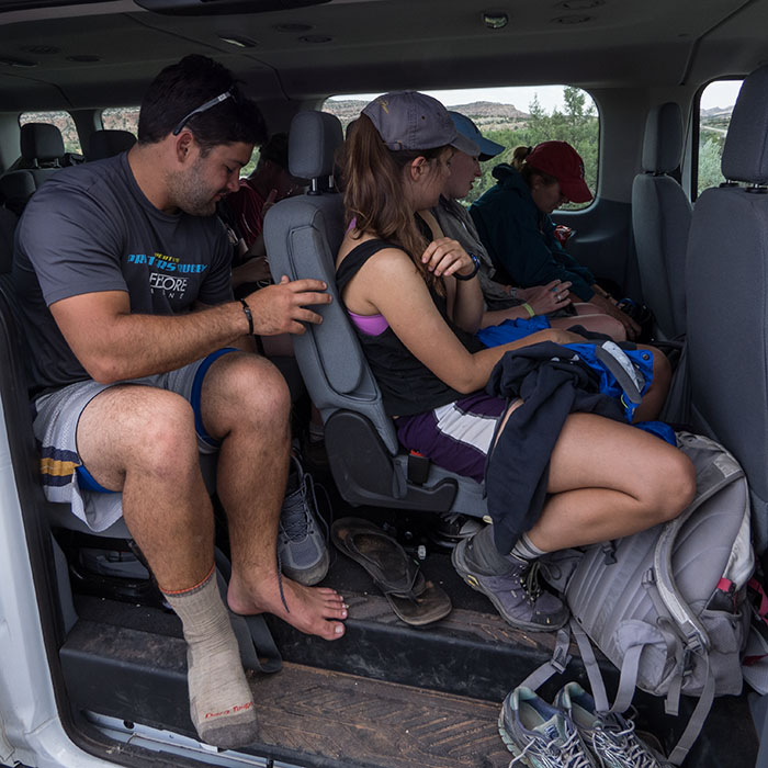
Allen packed to the brim.

Hiking up Comb Ridge.

Ephemeral pools on Comb Ridge.

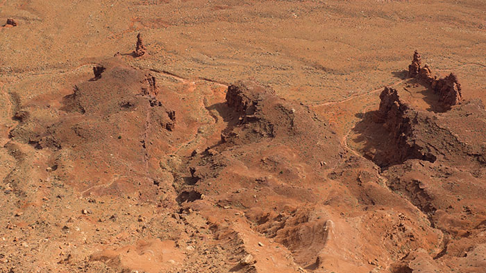
At the crest of Comb Ridge, a very long and impressive monocline.

View from Comb Ridge. Comb Wash, our camp site, is just south of the highway to the right of the brown dirt road. If you squint a bit you can see our yellow LL Bean tents.
We spent some time at the overlook, taking in the ruins before following a small drainage uphill towards the crest of the ridge. Our hike followed a series of ephemeral pools. A few years ago they were full of tadpoles. This year we find hardly any. Maybe we are too early in the season. The view from the ridge is as breathtaking as ever, and our students learned a bit about the uplift of the Colorado Plateau, synclines, anticlines and – of course – monoclines.
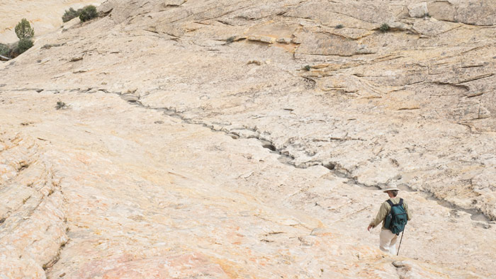
Joan on her way back down the ridge.
The return trip down the slickrock was pretty fast, and we decided to check out the Anasazi ruins in Mule Canyon. The entrance fee is pretty steep but well worth it. We hiked into a small canyon, enjoyed the lush vegetation and kept our eyes open for some ruins.

At the Mule Canyon trailhead.
The ruins were not that hard to find. Clearly, some (all ?) of the thousands of visitors that cam before us had found them already and left a clear path up the side of the cliff. The ruins were small, most likely re-built, but still pretty impressive. We were glad we came. Pretty big, black rain clouds made us beat a hasty retreat but, again, we didn’t see more than a few sprinkles, though it rained quite a bit later that night.

Anasazi ruins in Mule Canyon.

Bonus cottonwood! One can never have enough cottonwoods in a blog post.